


The tasks of roads and airfields GPR surveys
The GPR used in the roads inspection and airport transport infrastructure (runways, taxiways, aprons) in order to obtain continuous information about the condition and structure of road structures
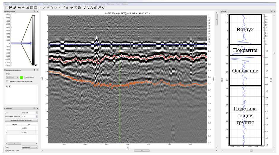
Most often, destructive methods are used to determine the thickness and material properties of the layers. However, such approaches provide the obtaining data possibility of a local nature, which creates conditions for the blind zones formation during the examination
The GPR method does not replace destructive methods, but allows obtaining additional data in the inter-borehole space, for example, to detect local deviations in the road structure layers thickness or weakened zones
Below is a list of typical tasks that can be solved with the GPR when inspecting transport infrastructure facilities
| Type of work | A task | ||
| Design | Construction | Exploitation | |
| Determination of layer thickness | • Calculation of the elasticity modulus of existing pavements for the reinforcement design • Calculation of an equal-strength structure when the subgrade is widened |
• Volumes substantiation and places of tunneling/sampling for acceptance inspection • Evaluation of the pavement layer thickness compliance with the design parameters • Control of the work performed volume to fill out reporting forms |
• Evaluation of the existing pavement strength to assign the type of repair • Determining the milling depth of an existing pavement • Search for signs of the weakened zones base of pavement by the local asphalt concrete subsidence |
| Determination of anomalies on GPR profiles | • Areas identification of weakened zones distribution in the base of pavement (decompression, waterlogging, emptiness) • Adverse man-made or natural processes and phenomena identification (karst, suffusion, flooding, frost heaving, etc.) • Natural soils strength evaluation (detection of organic, saline soils, fractured rocks, etc.) • Subgrade stability evaluation (determination of GWL, fluid plastic soil lenses, etc.) • Landslide deformations size forecasting (assessment of the break edges signs development and sliding surfaces on the subgrade slopes) • Pavement design changes evaluation in the longitudinal and transverse directions |
• Volumes and places substantiation of tunneling/sampling for acceptance inspection • Compliance assessment the homogeneity of properties materials of the pavement layers and subgrade soils |
• Determination of the causes of road surface destruction and the subgrade deformation • Evaluation of pavement design changes in the longitudinal direction to plan detailed surveys • Substantiation of measures to protect the problem areas structure to safe operation ensure |
| Characteristic reflections detection on the GPR profiles | • Mapping of engineering communications and other buried structures • Determining the location of concrete and reinforced concrete slabs under asphalt concrete • Determination of reinforced concrete structures reinforcement |
• Quality control of reinforced concrete structures reinforcement • Quality control of cast-in-situ concrete and pile cementing |
• Reinforcement schemes determination for concrete structures and prestressed reinforcement location • Reinforcement corrosion evaluation in reinforced concrete structures • Clarification of the utilities location |
.
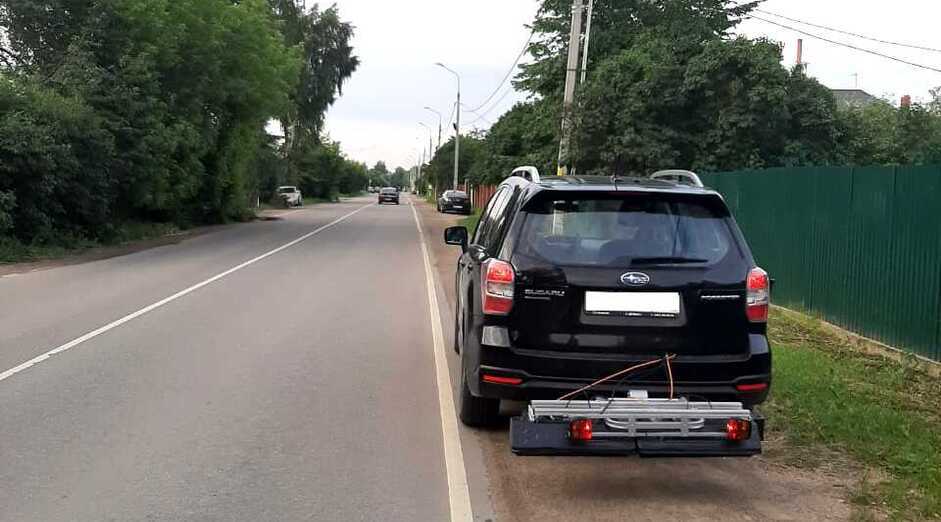
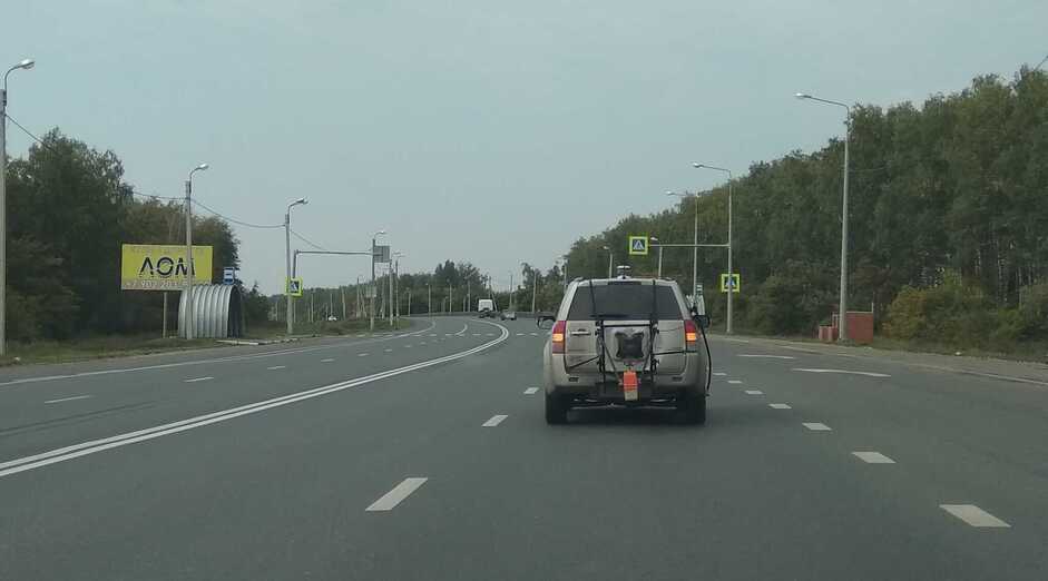
Shooting can be done both on foot and using a vehicle:
The historically established picketing system of Russian roads today during high-speed GPR scanning can no longer provide the necessary accuracy when fixing and further localizing a section that has certain deviations. When performing GPR surveys satellite positioning systems are of particular importance. In particular, to solve the high level responsibility problems, satellite receivers of a geodetic class are used, operating in the differential mode RTK (Real-Time Kinematic) or with the trajectory calculation in post-processing, receiving base stations corrections
Accurate GPR data referencing is the most important aspect of the above tasks objective solution with the operational control possibility of the GPR data correct interpretation