TRAINING "ABOUT GPR WITH GEOREADER SOFTWARE"
According to scientific definitions, ground-penetrating radar (GPR) is a geophysical method based on the emission of pulses of electromagnetic waves and registration of signals reflected from various objects of the probed medium
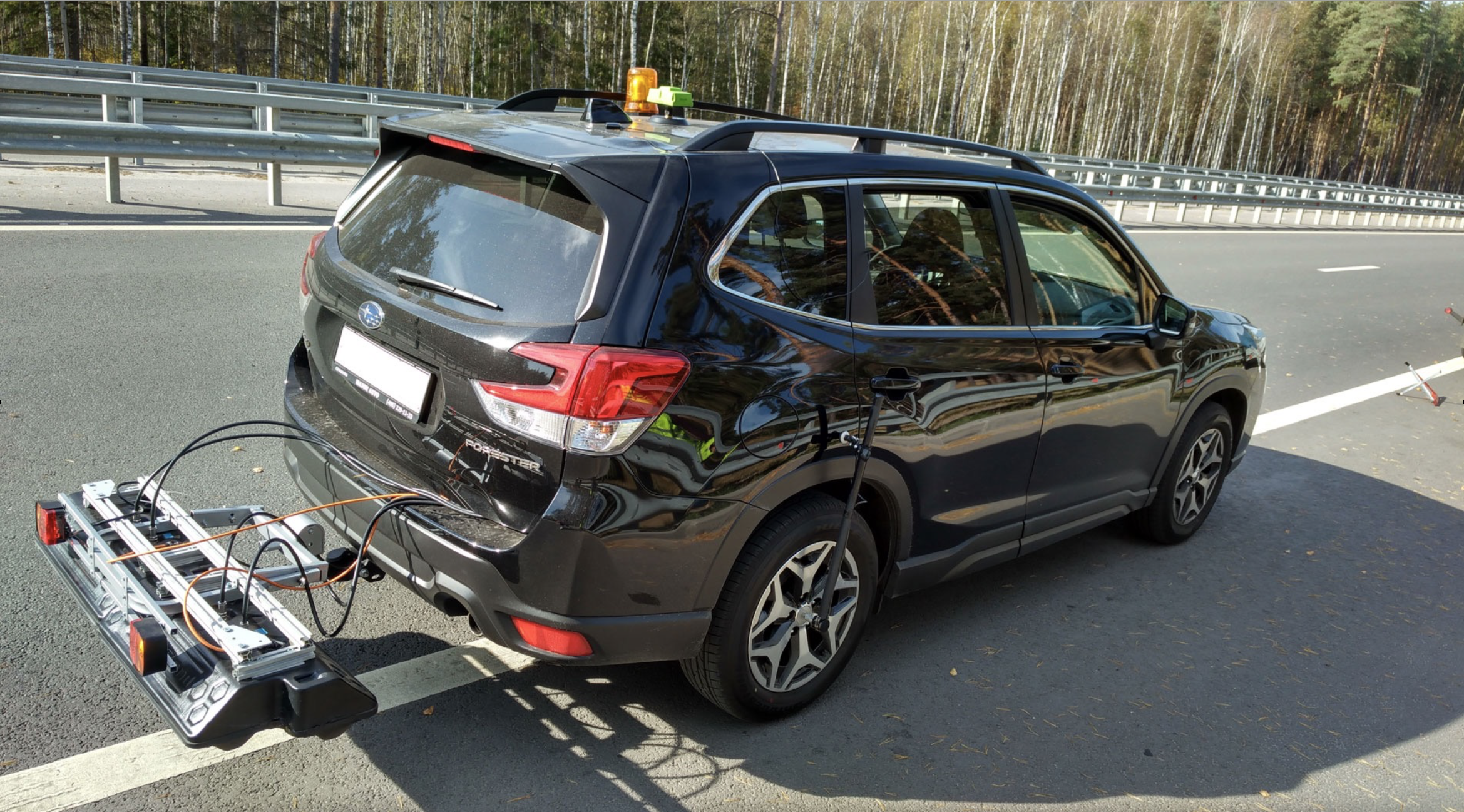
The device, which implements the principles of ground penetrating radiolocation, is called GPR. Its main elements are a impulse generator with a transmitting antenna, a receiving antenna and a control unit
Information from the theoretical foundations can be found on the page INTRODUCTION TO GPR
- Examination of wave propagation in the soil
- Development of ultra-wideband impulse antennas
- Construction of electronic units for GPR
- Processing of received electromagnetic signals
We have experience and knowledge in the collection and processing of GPR data and, at the request of the user of the GeoReader Software, we willingly share this knowledge
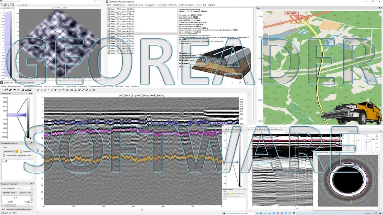
During consultations, we analyze the principles of operation of the GeoReader Software package, solve applied engineering problems of road construction
A standard set of topics for the training "Interpretation of GPR scanning data in the GeoReader software":
1) Introduction to the method. Equipment. Physical foundations. The concept of a track and a radarogram. Electrophysical characteristics of media (dielectric constant, speed of propagation of radio waves, attenuation). Resolution and depth; the effect of the antenna frequency on them. Survey technology
2) Basic principles of radarogram processing. Time and depth section. The problem of determining the speed
3) Highlighting the boundaries of soil layers. Convert time section to depth
4) Determination of radio wave velocities in boreholes
5) Diffracted hyperboles on the radarogram. Search for local inhomogeneities by hyperbolas. Determination of the speed of propagation of radio waves by diffracted hyperbolas
6) Determination of radio wave velocities using the amplitude method
7) Import of initial radarograms. Saving / loading radarograms
8) Program interface. Main areas, windows, menus, toolbar. Working with the mouse. Bar graph
9) Basic operations for processing radarograms: reflection, cropping, removal of faulty traces, reduction to zero, smoothing, zero drift correction, gain adjustment, filtering
10) Attribute Analysis
11) Working with trajectory and coordinates
12) Working with elements (points, segments, hyperbolic hodographs, rectangles, texts). Working with borders. Autosearch for borders. Well work. Group operations with elements
13) Convert time section to depth
14) Determination of the speed of propagation of radio waves by the method of amplitudes
15) Working with layers. Exporting layer thicknesses to DXF and CSV
16) Work in the project manager (batch processing of radarograms)
17) Working with the module "AmplitudeMap"
The development of GPR in road construction today is a priority in solving road construction problems in many countries. This is due to both innovative developments in the hardware and the creation of new optimal algorithms for processing radarograms when performing the tasks of repair / construction of roads, airfields, etc.
Contact us, friends, and we will be happy to answer your questions!