


City road survey
GPR city road survey has a number of distinctive features compared to country roads
Field works are usually carried out during the minimum traffic flow hours
For positioning GPR data, it is possible to perform work in the RTK mode, due to the confident coverage of the territory of cities by mobile Internet and a small distance from the reference base stations
Data processing is more labor intensive as in addition to the boundaries position interpreting of the pavement and the weakened layers zones of its base, it is necessary to detect and take into account the negative impact of engineering communications
The operating conditions deterioration of underground structures, such as pedestrian crossings, tunnels, etc., the decrease in the pavement evenness, the formation of roadway subsidence or sidewalks occur due to the winter redistribution of moisture and the subsequent air temperature transition “over 0”. Frozen water in the ground expands and the structure destroys, warming leads to a soil volume decrease of the due to thawing of ice. Thus, the processes of frost heaving and shrinkage weaken the road structure and subsidence is formed. Voids in the base occur as a result of suffusion, washing out of soil particles and their removal, incl. to the engineering communications collector
The GPR city road survey involves the identification and analysis of all hydrogeological object of study conditions, since it is the moisture level redistribution and the physical and mechanical properties of materials that are of paramount importance for the roads life
The features of the city road surveys must also be added:
1) the building materials draining properties are one of the conditions for the road structures strength characteristics and in urban areas directly affect its service life through the moisture levels redistribution
2) urban roads have an extremely heterogeneous structure, the main reason for which is the performance of work in different periods using different materials
3) underground communications complicate the construction process, and when GPR surveyed, they often create significant radio signal interference
4) the tasks of city roads GPR survey are much more diverse, which is caused precisely by a large number of underground communications, engineering structures, and various underground facilities
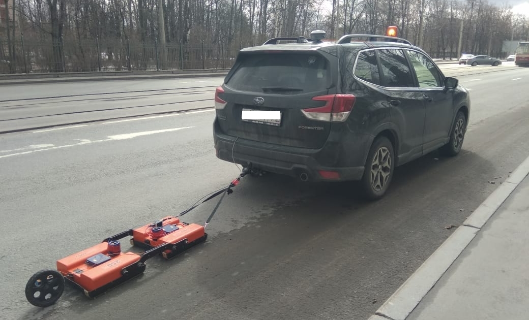
In April 2022, with the ROSDORNII Accelerator support, we took part in a pilot project in the city of St. Petersburg
The purpose of the pilot project is to identify the causes of subsidence on road surfaces and assess the utility networks impact on the road structures destruction
A survey was carried out by OKO-2 GPR (by GEOTECH LLC) and GRT GPR (georadiotomograph, by TerraZond) along the total roadway length of about 24 km. At the same time, taking into account the multichannel GRT GPR data, GPR profiles were obtained with a length of almost 150 km
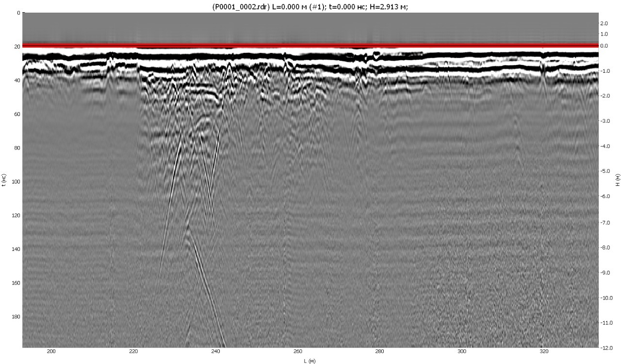
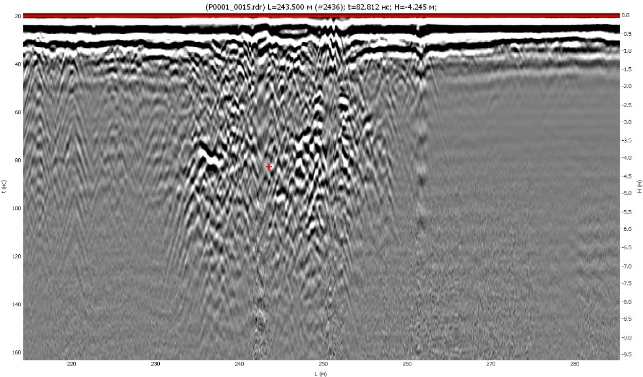
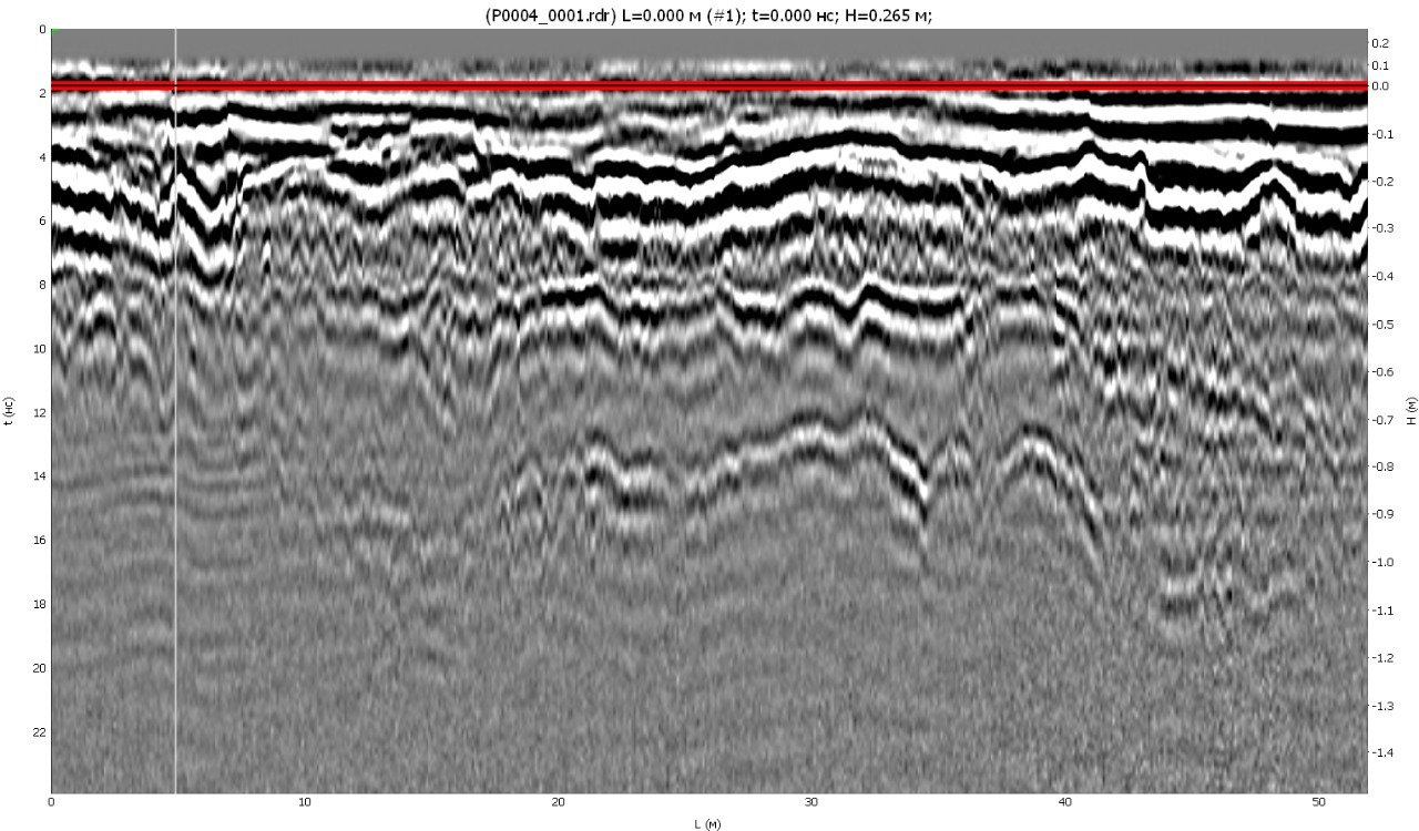
Below are fragments of radargrams obtained by the OKO-2 GPR
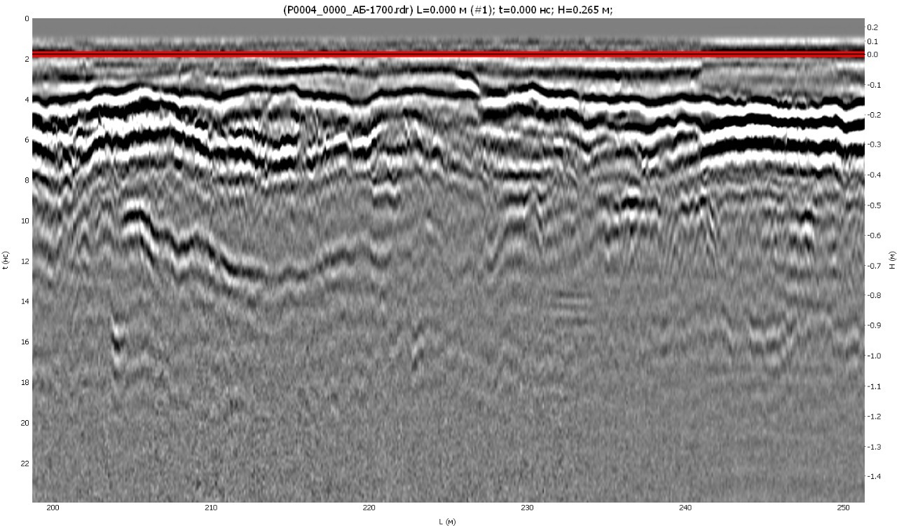
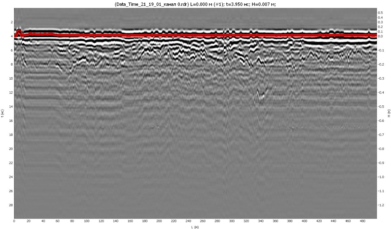
GRT data have a more complex processing procedure, but the multichannel data project provides more information for analysis and opportunities for working in the GeoReader software. The radargram is presented below, and we will show later the final project processing results
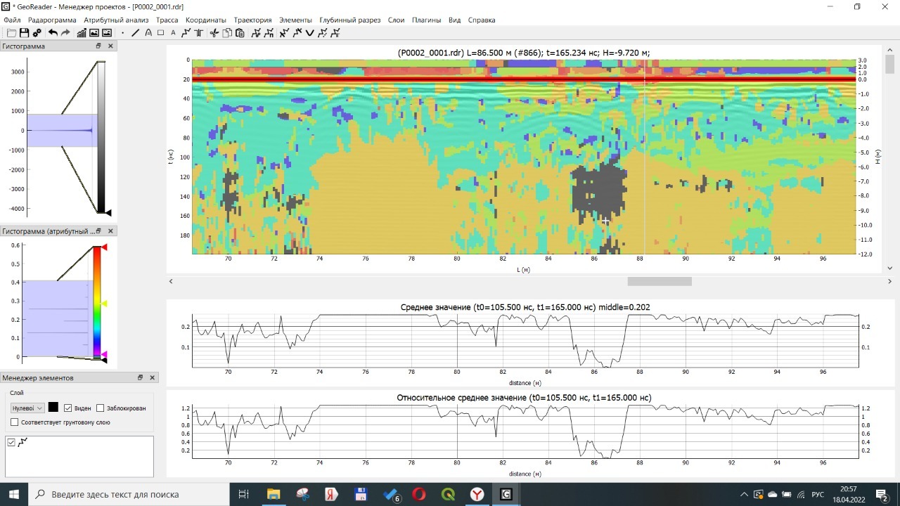
At the moment, the radargrams processing is being carried out and at the same time being created a new method for processing the GPR survey results, which will allow you to quickly assess the pavement bases conditions, detect areas of decompaction and waterlogging
In the course of processing, already at the initial stage, using attribute analysis algorithms, it was possible to obtain an interesting result by the places determining of decompaction / waterlogging on the radargram
Due to the complexity of conducting complex ground penetrating radar surveys using destructive methods, the technology of non-destructive pavements testing (base soil properties) by the shock loading method (Falling Weight Deflectometer, FWD) was used in the framework of this work
We will tell you about the work results done later. Follow the news on social networks (links are at the page bottom)