Filtration and amplification of GPR data in GeoReader Software
After collecting GPR data, their processing is carried out - bringing the radarograms to the most readable state in order to solve the project's problems. GeoReader software also uses amplification and filtering functions for preprocessing radarograms
In accordance with the instructions, setting the gain (attenuation) of the signal allows you to enhance weak reflections and, conversely, weaken strong ones. Can be performed along the current track, along the middle track and automatically
Menu: Radargram - Gain - Gain Adjustment for Current Trace ...
Menu: Radargram - Gain - Gain Adjustment for Middle Trace ...
When you select these menu items, the gain settings window opens:
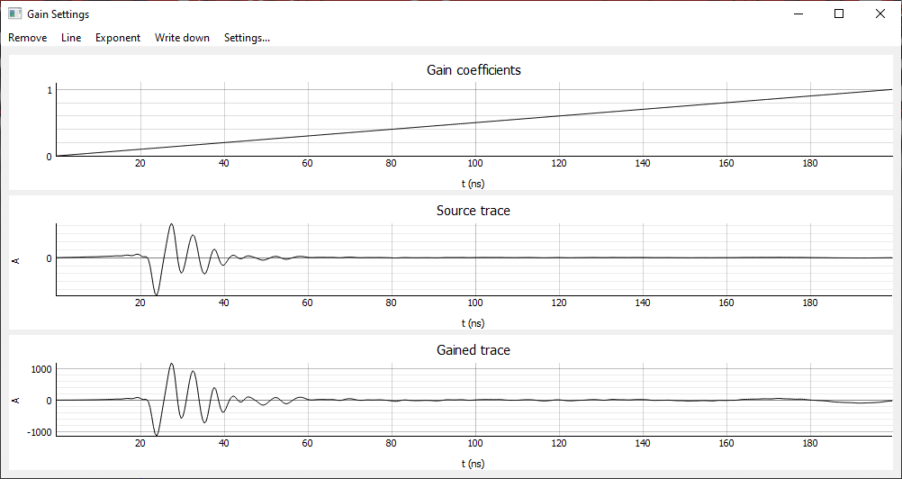
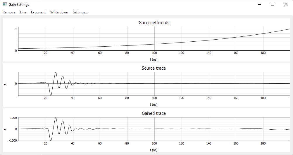
The top part of the window displays a graph of the gains (from 0 to 1). The middle part shows the original (current or average) trace, and the lower part shows the reinforced trace. The gain trace is calculated by multiplying the original trace by the appropriate gain
When you select the Remove menu item, all gains become equal to 1, that is, the trace does not change
When selecting the Line menu item, the gains change linearly from 0 to 1
When you select the Exponent menu item, the gains change exponentially from 0 to 1. The shape of the exponent depends on the gain (from 1 to 100), which can be changed by selecting the Settings ... menu item
Besides, the graph of gains can be changed manually by clicking on the corresponding area of the graph. The value of the time interval when manually changed can be changed by selecting the Settings ... menu item
When you select the menu item Write Down, the gains are recorded and the radarogram changes
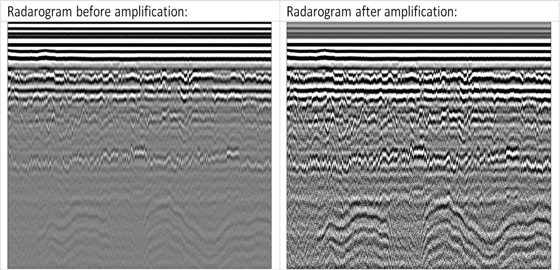
Often a high-quality result is obtained by the amplification function "Vertical Amplitude Normalization" (or Horizontal...)
Vertical amplitude normalization dynamically aligns trace amplitudes to a single range in order to lower amplitudes result in higher ones. Sets the number of samples for which the amplitude reduction is performed. Normalizing the amplitudes vertically is one of the ways to automatically adjust the signal gain
GPR-trace before conversion:

GPR-trace after conversion:

"Horizontal Amplitude Normalization" dynamically aligns the amplitudes of all traces of the radarogram to one range. Usually it is necessary either when attaching another radarogram, or when processing radarograms obtained when performing GPR sounding on a variable base (using the common depth point (CMP) method)
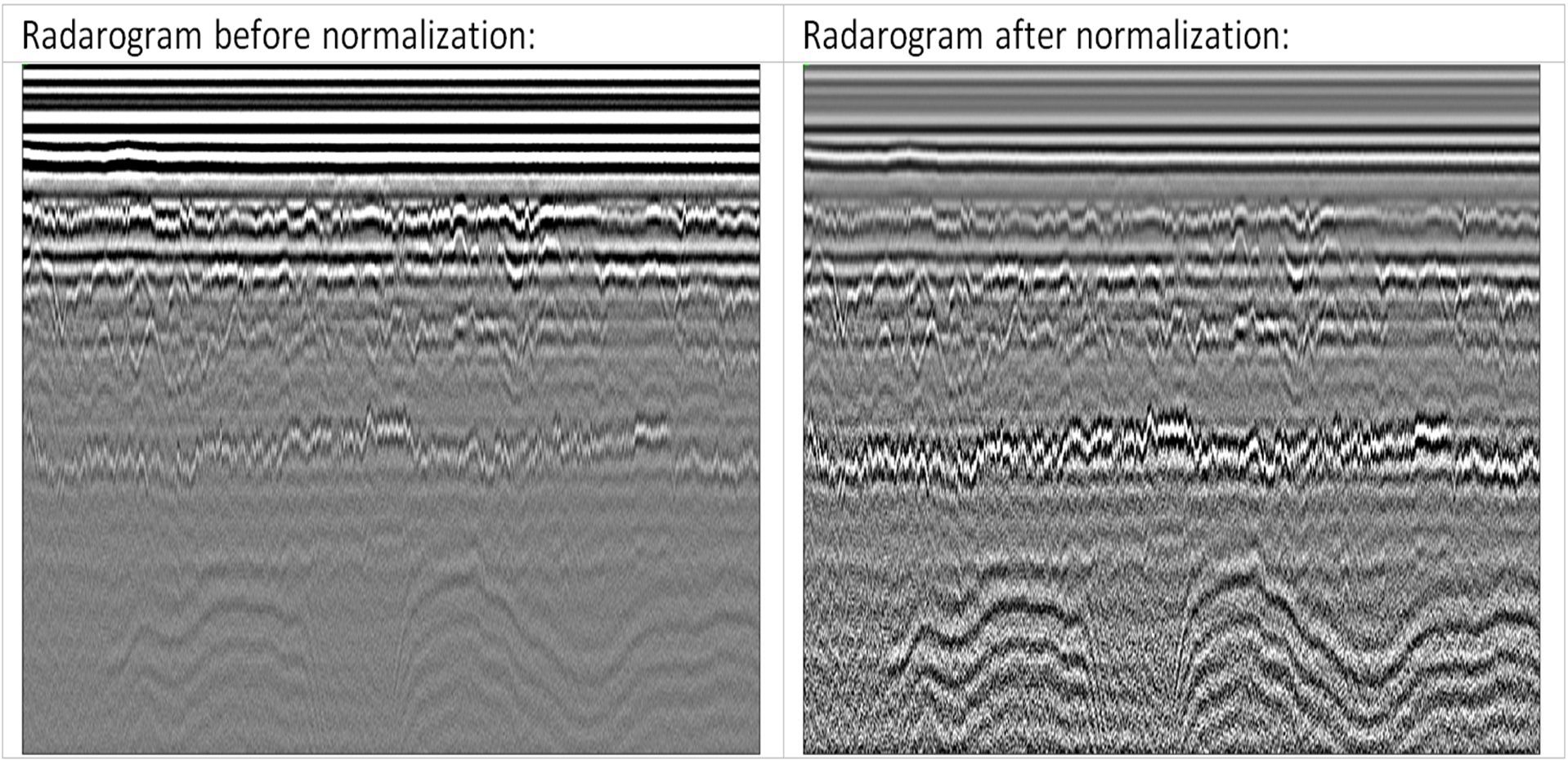
Along with amplification, and sometimes in pairs, we get a good result with filtering. GeoReader implements frequency filtering functions (along the average and current trace) and the dewow filter, which is widely used by colleagues abroad
A direct Fourier transform is performed along the average or current trace and a spectrum is constructed (amplitude-frequency characteristic of the signal):
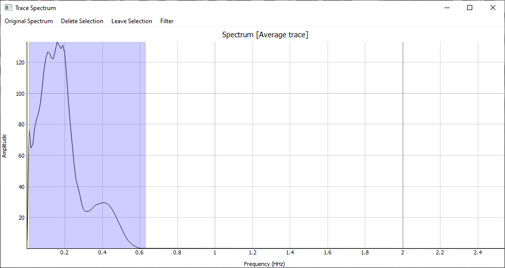
The Delete Selection button resets the frequency amplitudes corresponding to the blue rectangular area
The Leave Selection button, on the contrary, zeroes all amplitudes outside the blue rectangular area
The Original Spectrum button returns the spectrum to its original state
By clicking on the Filter button, the inverse Fourier transform is performed for each trace, the radarogram is filtered
A good result is shown by using the dewow filter. Its task is to suppress frequencies below 2% of the frequency field of the spectrum. Used to remove noise caused by antenna characteristics
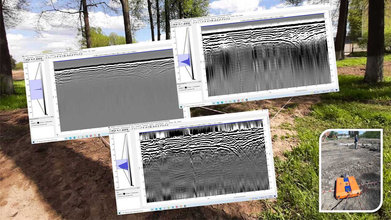
At the last work (search for burial sites and underground structures in the park area), the following results were obtained using the dewow filter:
1) original radarogram №1:
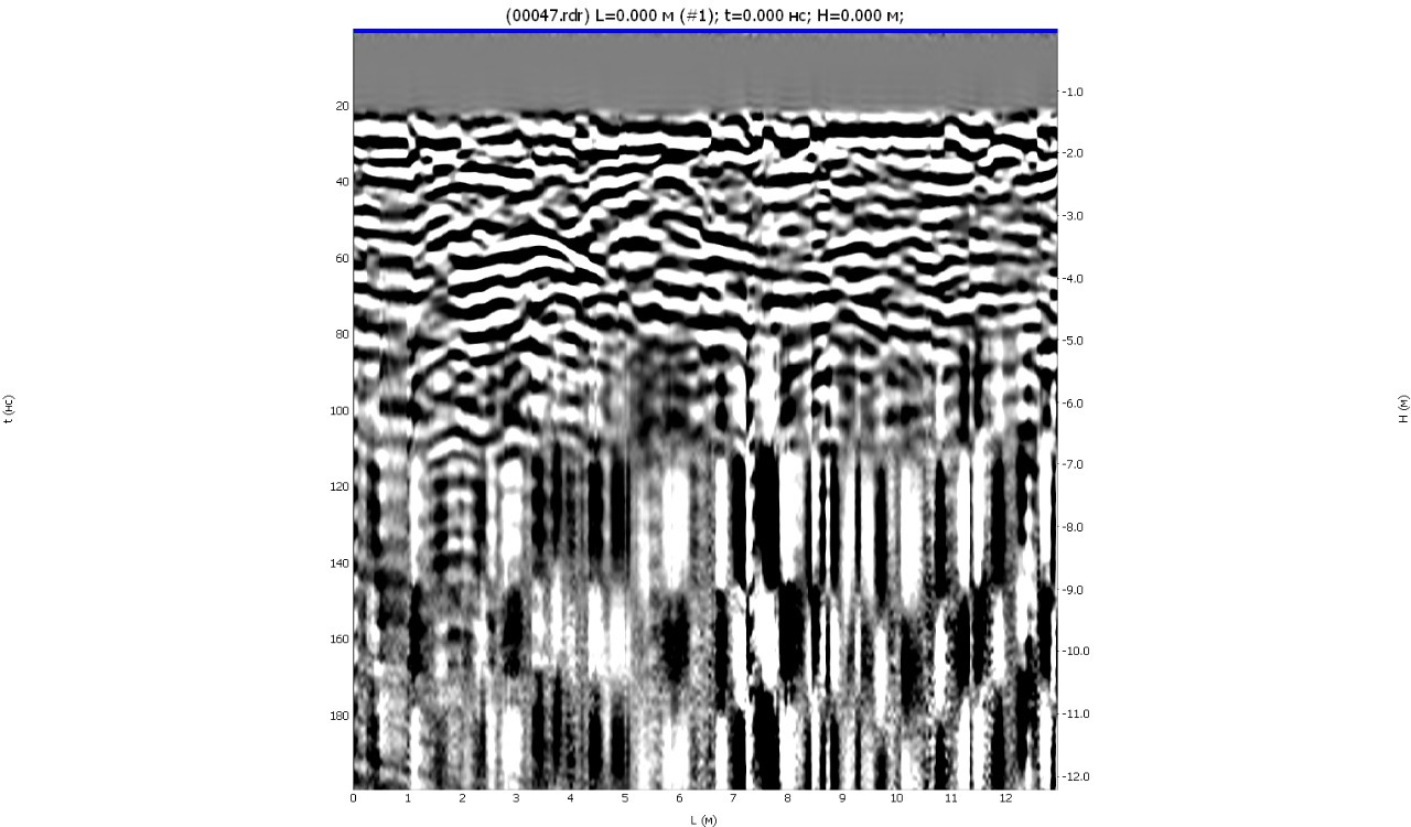
2) Dewow filter on radarogram №1:
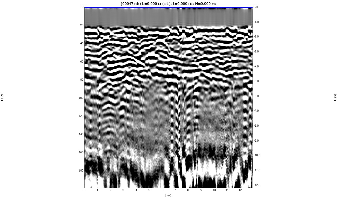
3) Original radarogram №2:
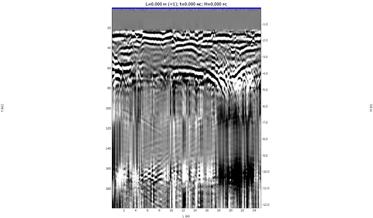
4) Dewow filter on radarogram №2:
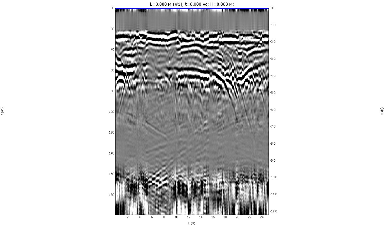
As you can see, the use of amplification and filtering functions in GeoReader Software allows you to increase the useful depth of the survey by 2 or more times!
Try GeoReader software to solve your project problems


