


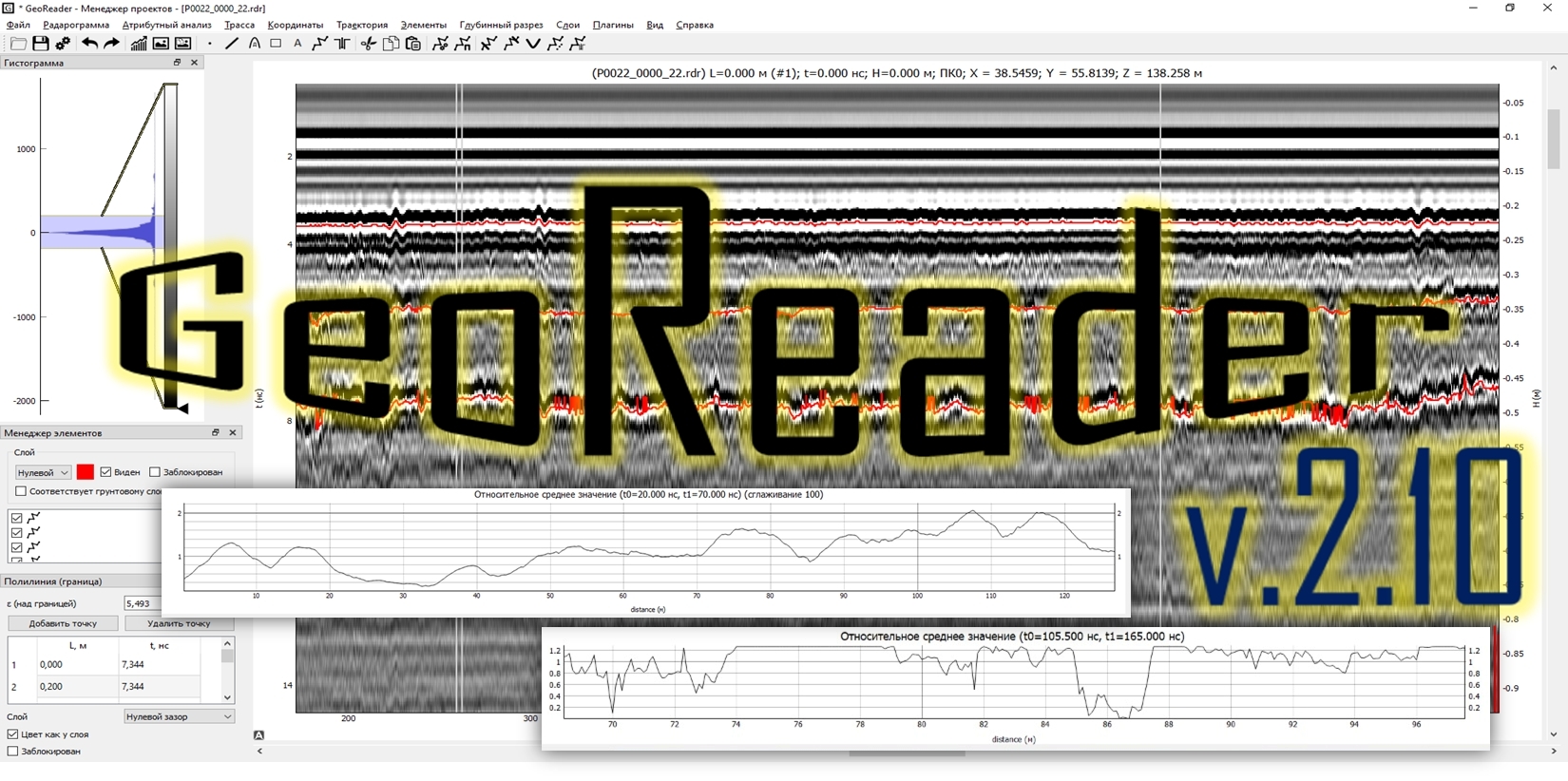
Presentation of version GeoReader v2.10
 Our own scientific research and constant achievements monitoring of world GPR market leaders allows us to be one step ahead today. We are constantly improving GPR data processing algorithms in GeoReader software, adding new functions and improving existing ones
We present a new version of GeoReader software today - v2.10
We highlight the following among the important improvements:
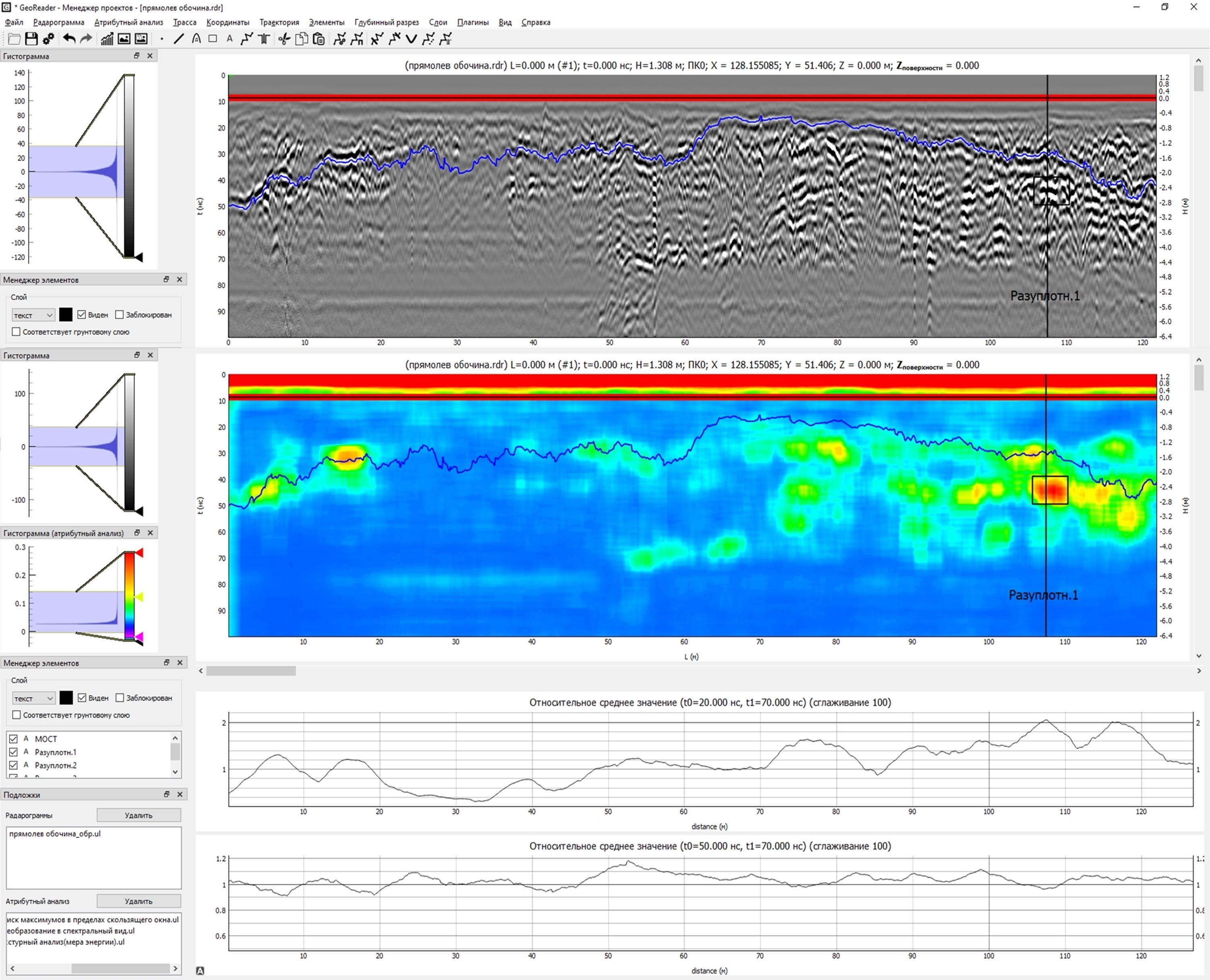
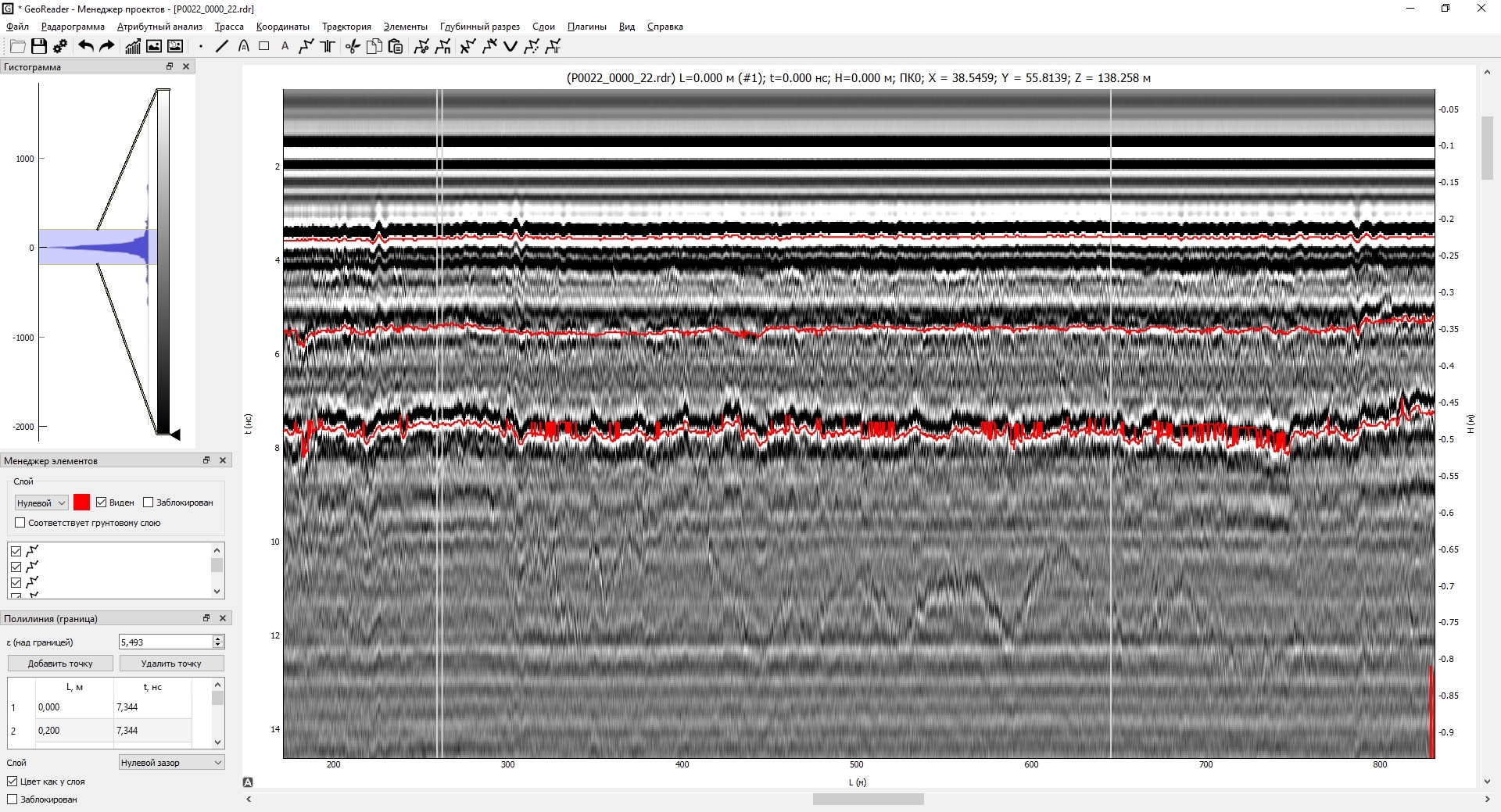
1) the module "Applied tasks" has been improved - Calculations of relative strength and relative humidity
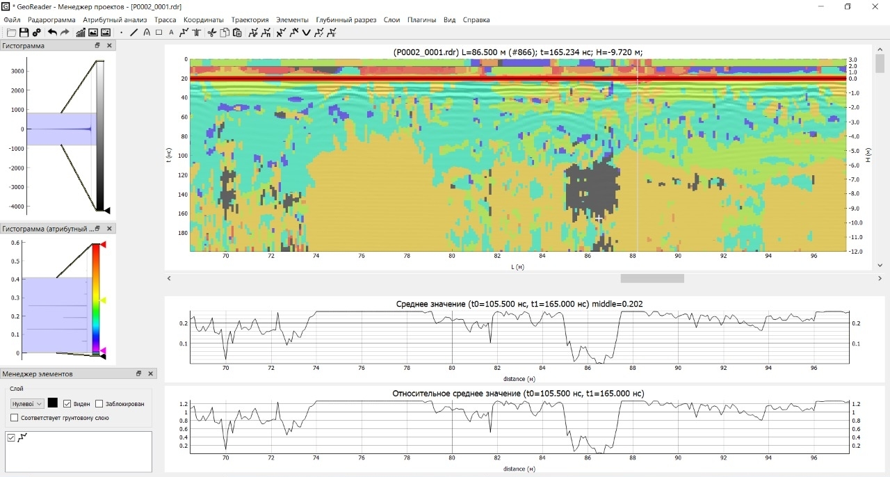
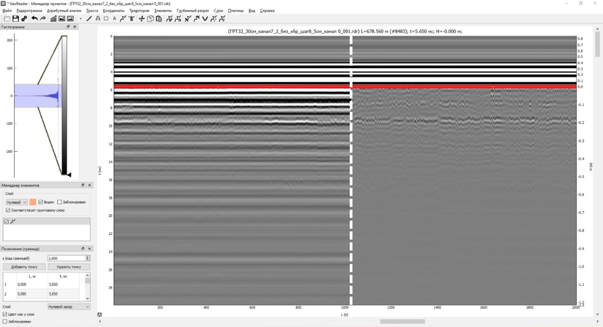
2) added subtraction of the average under the border
3) transition to the picket along the highway
4) when unloading point elements, hyperbola parameters are unloaded
5) integration with the AI cloud service has begun
These functions are different in importance and novelty. So, calculations of relative strength and relative humidity are quite worthy of being separate applications, but at the moment everything will work in the GeoReader software package. Let's talk more about the latest developments
Algorithms for calculating relative strength and relative humidity are based on the recommendations of clause 7.8 of ODM 218.3.075-2016 "Recommendations for quality control of road construction works by georadiolocation", which refers to the dependence of the uniformity of the properties of subgrade soils and materials of the base layers of road structures on the amplitude reflected signal. The calculation is performed at a given interval of the length of the object and the depth specified by the operator (in the current version it is set according to the GPR signal penetration time scale, in nanoseconds)
.
The result of the algorithm is the assessment of the strength / moisture content of the area (in percent), which was set by the operator when starting the algorithm, relative to the value recommended in ODM 218.3.075-2016:
- for strength - "an increase in the signal amplitude at the depth of the controlled layer by 2-4 times or more (depending on the frequency of the antenna unit, type of terrain, type of material or soil being probed, etc.) compared to the average value"
- for humidity - "a decrease in the signal frequency at the depth of the controlled layer by a factor of three in relation to the average value (for subgrade soils and additional layers of the pavement base)"
 .
.
Based on the our performed works, the optimal length of sections for calculations was set at 50 m. This length of the section also made it possible to correlate the results with the requirements for the examination by the Falling Weight Deflectometer (FWD), according to GOST R 59918-2021 "Public automobile roads. Non-rigid pavement. Assessing strength methods"
Subtracting the average signal "under the boundary" allows you to remove unnecessary reflections / re-reflections, which sometimes occur even from the boundaries during the passage of the GPR signal
.
Switching to the trace number by the picket also turned out to be a very convenient function when searching for a point (GPR trace) on the radargram, if the values of the well are specified in pickets. We also plan to add a transition by mileage (from the project beginning)
The continuous improvement of existing features, thanks to the feedback from our users, allows us to make GeoReader more convenient to use. So, one of the most used functions - export of point elements to CSV - previously did not make it possible to obtain the parameters of hyperbolas (used to obtain information about the average speed of radio waves above the object and its depth by estimating the angle of inclination of the hyperbola branch)
We're also preparing the platform's work with a AI cloud service integration, the task of which will be to fully automate processing of radargrams - computer vision will automatically highlight the boundaries of the road structural layers and heterogeneity for diagnostic tasks. The first tests have already been carried out and show satisfactory results. The need for high-performance processing of radar images to continuously obtain information about the road structure at each stage of the life cycle of the road is confirmed by user feedback
.
Thus, at the design stage, obtaining information about the subsurface structure along the entire length of the pavement will create conditions for taking into account all the shortcomings that were missed by destructive methods (drilling did not allow obtaining information about anomalies in the interwell space, which led to suboptimal design decisions and premature destruction of the road structure ). At the construction stage, it will be possible to fast obtain information about the thickness of the laid layers of pavement (asphalt, crushed stone, sand, etc.), such work carried out by the construction company will avoid claims from the customer, as well as establish self-control and increase the efficiency of the construction resources using. During the operation of roads, constant monitoring and diagnostics of pavement will make it possible to record progressive deformations with picket and coordinate referencing, as well as to justify the scope of work (often in practice you can meet the replacement of the pavement while the cause of deformation processes originates in the lower layers - the working layer, or underlying soils)
Today, the developed neural network requires constant additional training of various GPR-datasets (with different antenna units) to ensure the quality of the final result. In this regard, we offer users, as well as our future clients, joint interaction to refine the neural network - in exchange for data-training, we are ready to offer further discounts up to 50% for 5 years, depending on the amount of data provided. Questions on interaction can be sent to us at the email address post@geotim.org, or in Telegram
Always with you, The "TIM" Company