


Presentation of version GeoReader v2.8
Hello, dear user of GeoReader Software and guest of our site!
We present to your attention the version of GeoReader v 2.8.
Key improvements are highlighted in the current version:
1) An automatic border correction function has been added to the GeoReader Project, which works in conjunction with copying borders to adjacent profiles (parallel channels of one passage).
In the updated version, the operator needs to use automated algorithms to find the boundaries of the layers on one of the parallel profiles of the GPR passage. Search for layers in other channels is fully automatic
2) Added commands:
а) for border correction in GeoReader - a new menu item Plugins - Autosearch borders - Correct border position
б) in the GeoReader Project for the already existing command of copying elements from the radarogram to the radarogram (the menu item Elements - Copy elements) a checkbox appeared "Correct the position of boundaries"
3) GeoReader Project added data on travel and channel number. When copying elements, a tick appeared, about restricting copying to radarograms of only the current passage
4) At the request of the Institute of Mining of the Ural Branch of the Russian Academy of Sciences (ИГД УРО РАН), a plug-in has been added to GeoReader for visualizing GPR profiles obtained by GPR scanning of the shaft walls
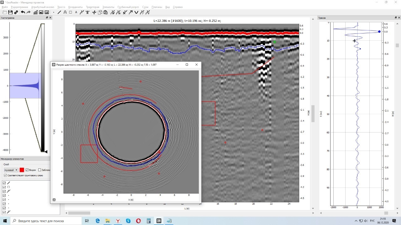
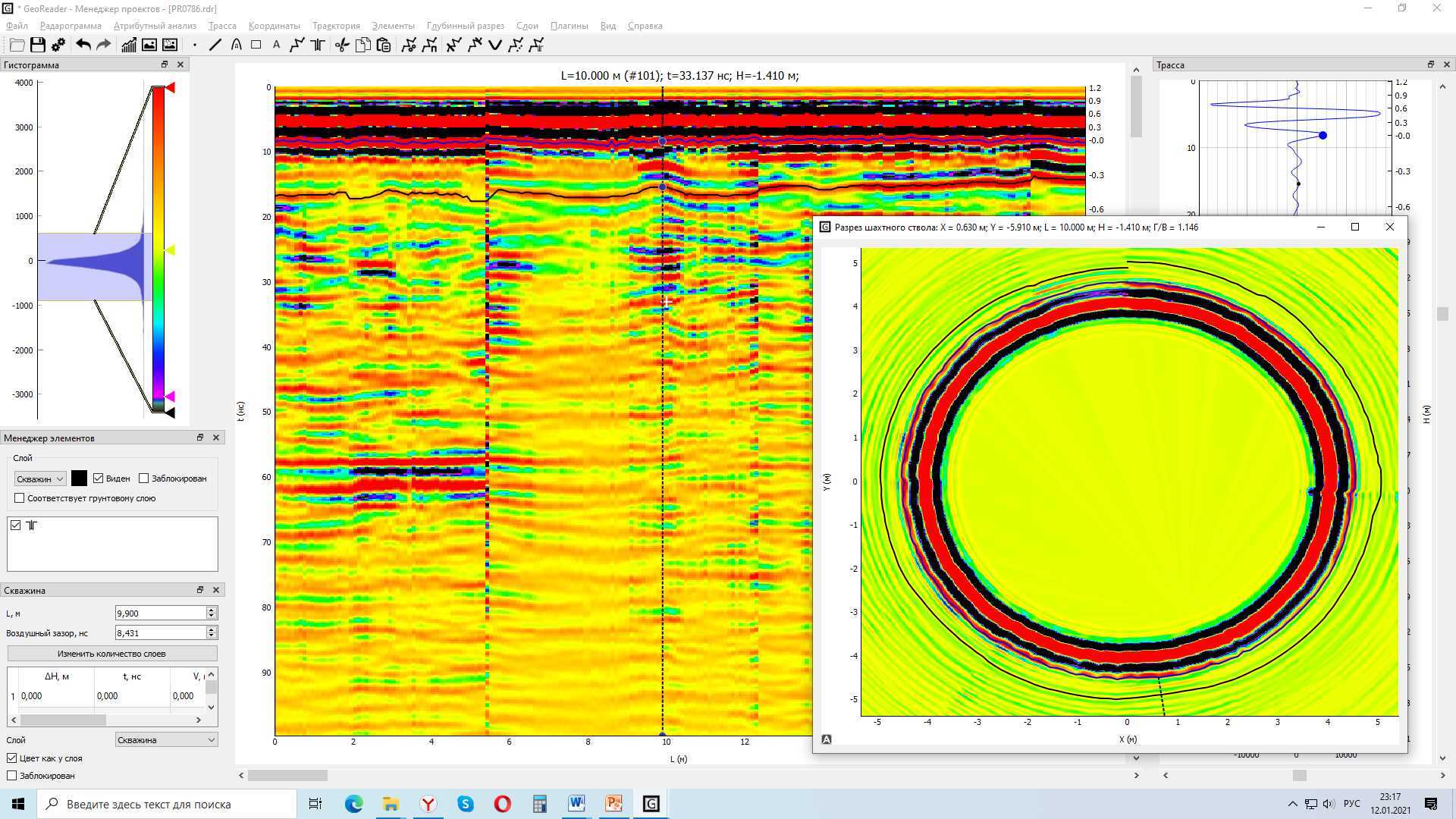
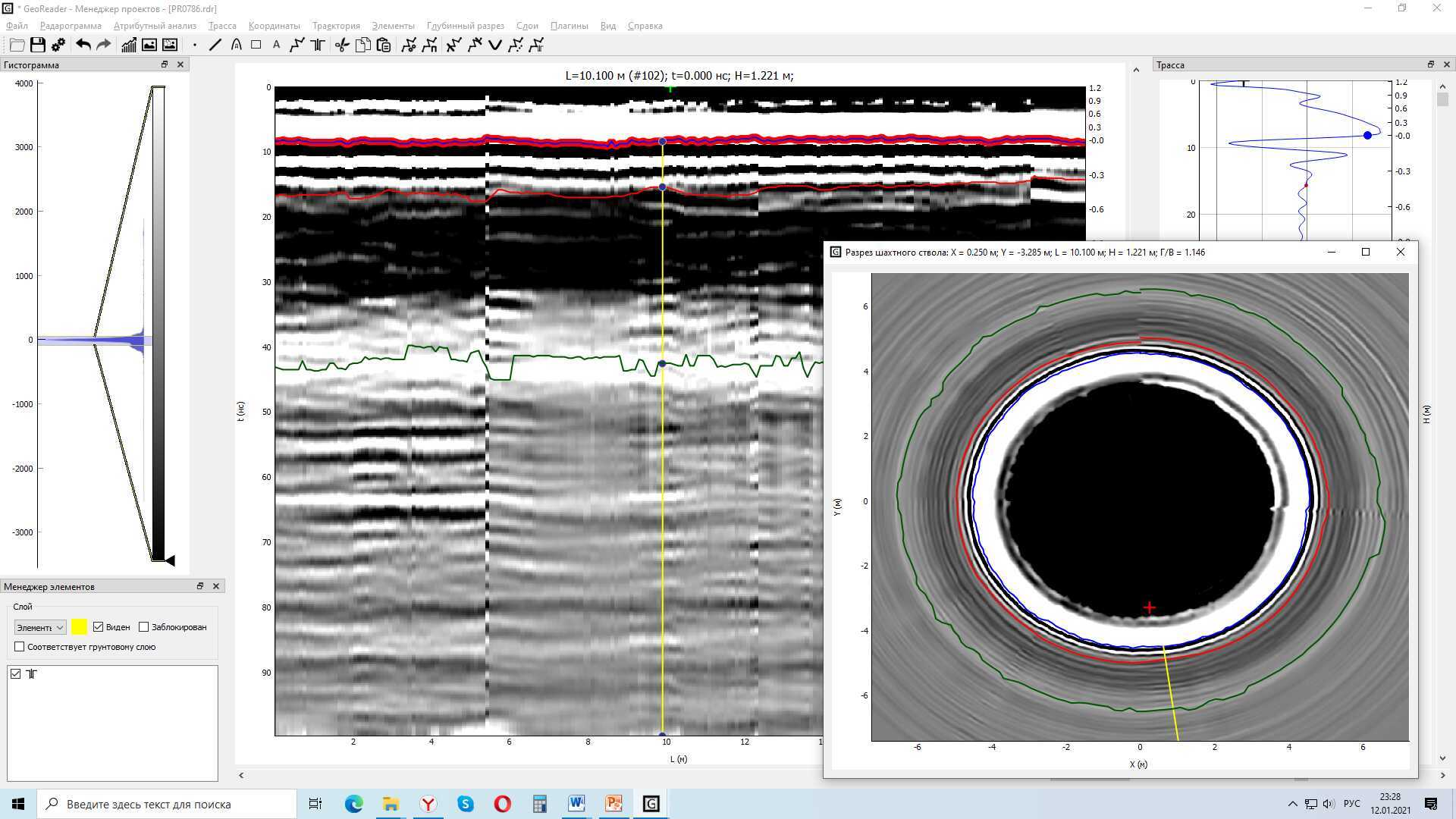
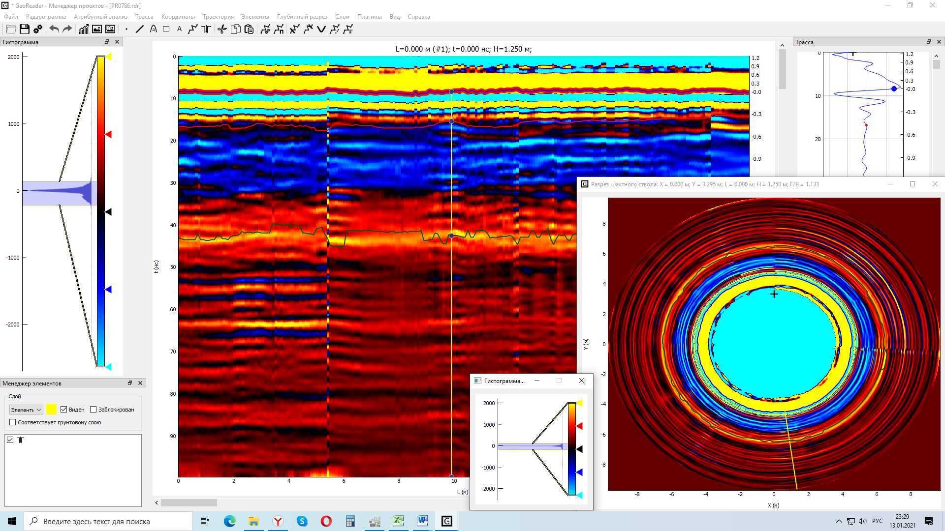
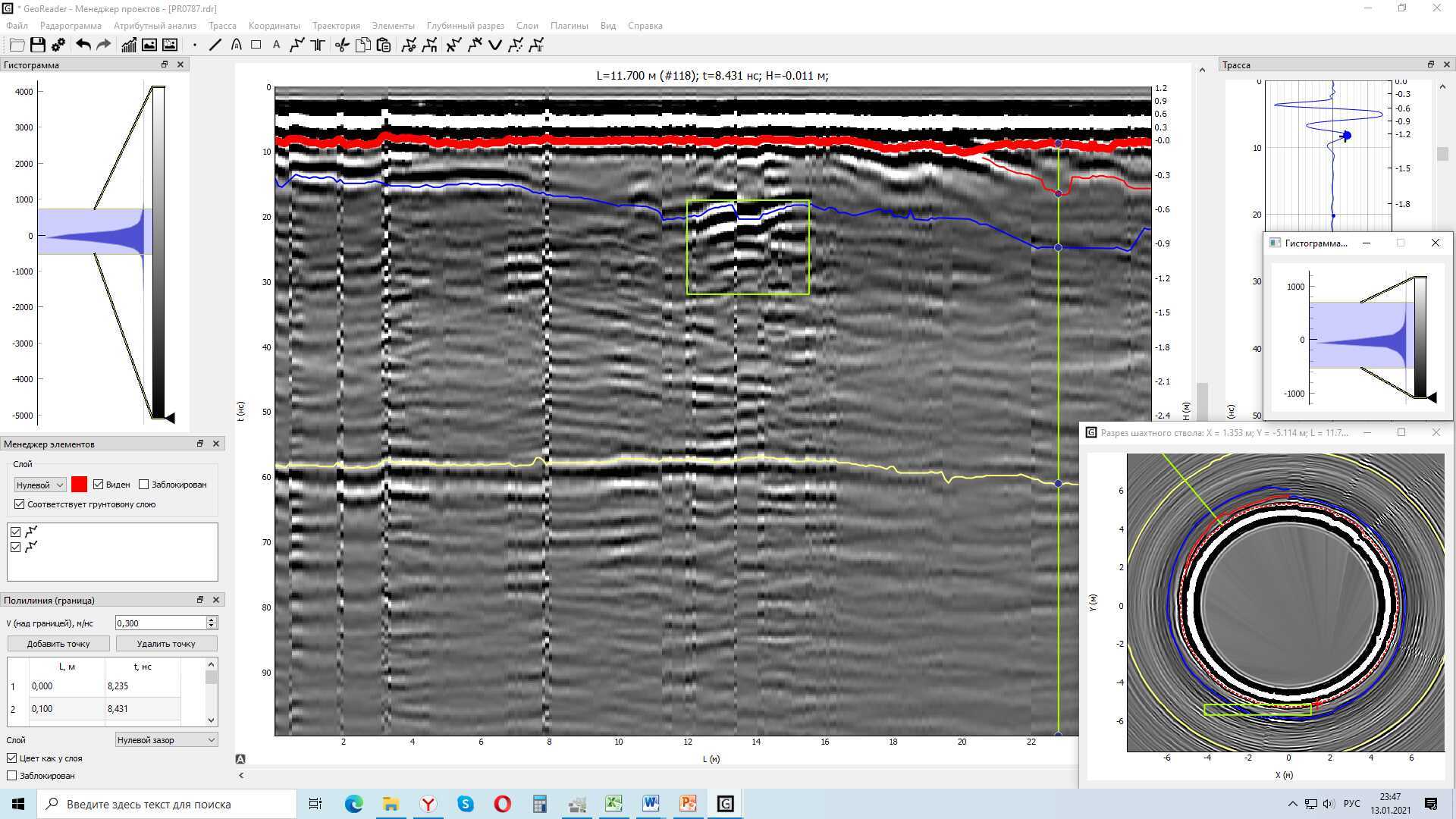
Concrete is the main component of the structure of the walls of mine shafts, and since it well dampens the radar signal, during GPR surveys, as a rule, data from the first 40 nano-seconds are used.
In mining, the use of GPR is advisable both in the construction of new shafts and during re-entry, reconstruction, prolongation of the use of the shaft with a change in the load on the shaft, for example, an increase in the air flow rate, when tracking destructive processes, such as squeezing the shaft or collapses, accompanied by damage to the lining. Today, ground penetrating radars are used to monitor the condition of the rock mass and support at potash mines.
The Institute of Mining with the help of GPR solves the following tasks:
• diagnostics of the state of concrete through the imaginary part of the complex dielectric constant;
• by changing the nature of the reflection of concrete / rock, the state of the border massif and aquifers is determined.
The industry prioritizes functionality for processing radarograms:
• attribute analysis,
• scaling,
• selection of borders,
• q-factor,
• the ability to review several profiles together in the GeoReader Project (project manager),
• combination of horizontal and vertical profiles,
• export to cad, csv or xls
Stay tuned for updates of GeoReader Software package
We invite you to try (click) GeoReader to solve your tasks!